Island of Molokai
Molokai
Molokai Area: 673.4 km²
Population: 7,404 (2000)
Highest elevation: 4,961 ft (1,512.1 m)
Largest settlement: Kaunakakai
History of Molokai
Molokai is a Hawaiian island in the central Pacific. Molokai was long inhabited by self-sufficient taro growers and fishermen. In the 18th century the kingdom of Oahu gained control over Molokai; its rule lasted until 1785, when warriors from Maui and Hawaii islands invaded and separately ruled the island. Hawaiian chief Kamehameha I invaded in 1795 and subordinated the population as part of his effort to unify the Hawaiian Islands. Christian missionaries arrived on Molokai in the 1830s. A large ranch was established by Kamehameha V, but this destroyed much of the island’s plant life and fishing ponds.
By the 1860s a colony had been begun for victims of leprosy (Hansen disease), and this led to the forced resettlement of many of the island’s natives, particularly from the Kalaupapa Peninsula, in the 1860s and 1890s. The Hawaiian Homes Commission Act of 1921 encouraged homesteading and resettlement on Molokai. Lack of water slowed development, but after 1923, with the growth of the pineapple industry, small villages grew up on the plateau.
The economy of the island suffered a setback in the 1970s and 1980s when the pineapple growers, facing stiff competition from abroad, closed down their operations. Agriculture on the island is now more diversified, with seed corn, coffee and sweet potatoes among the leading exports. Kaunakakai, the chief village, is on the south coast and has a small harbor.
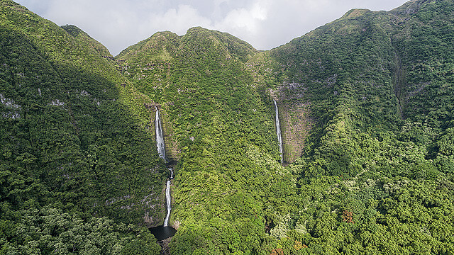
Halawa Valley – Molokai
Halawa Valley, valley, northeastern Molokai island, Hawaii, U.S. On the northeastern flank of Kamakou summit, it is a deep, verdant gorge 1.75 miles long and 0.5 mile wide.
Archaeological evidence dates habitation in the area from c. ad 650, which makes it one of the oldest Hawaiian settlements. The area possesses one of the most complete collections of ancient residential sites, more than a dozen heiaus (ceremonial and religious structures), and a large-scale irrigation system.
It is believed to be the longest continually occupied site in Hawaii. In the 13th and 14th centuries, it was one of the most densely populated parts of the Hawaiian Islands.
One of the few areas in eastern Molokai suited to agriculture and renowned for the taro root grown there, Halawa Valley supported hundreds of Hawaiians until disastrous tidal waves (1946 and 1957) destroyed most of the buildings and much of the vegetation. It is now occupied by a small number of fishermen and farmers, and it is largely a recreational area (hiking, surfing, fishing).
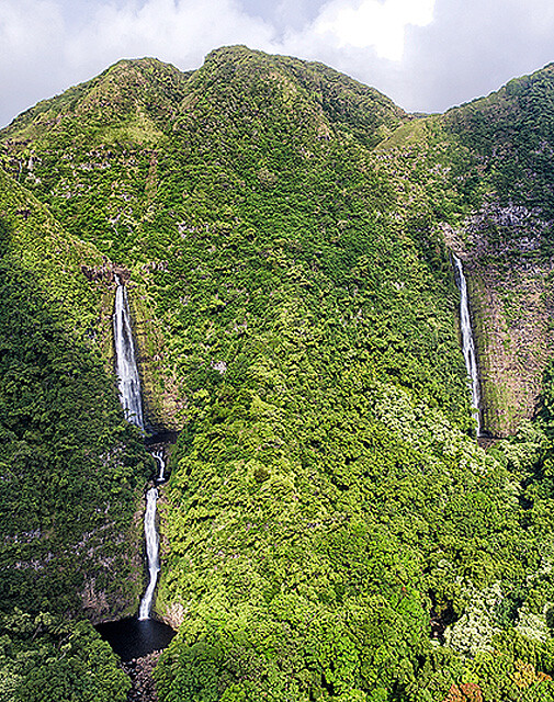
Hipuapua Falls and Moaula Falls
Hipuapua Falls drops about 500 feet. It is at the end end of the valley, is the area’s highest waterfall; also at the end of the valley is Moaula Falls – 250 feet. Legend says the pool below Moaula contains a moo, a giant lizardlike creature.
Leper Colony at Kalaupapa
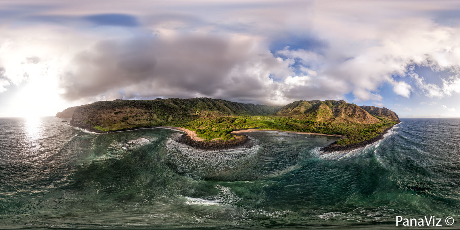
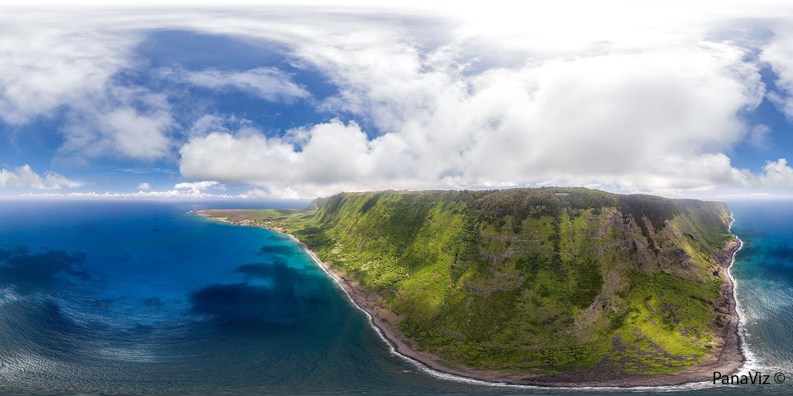
Kalaupapa Peninsula, also called Makanalua Peninsula, peninsula on the northern shore of Molokai island, Hawaii, U.S. Occupying a 5-square-mile (13-square-km) plateau unsuited to agriculture, the peninsula is isolated from the rest of the island by 2,000-foot (600-metre) cliffs. The panorama below was taken from the clifftop Kalaupapa Lookout in Palaau State Park.
It was formed more than 200,000 years ago from the flows of lava from nearby Pu‘u‘uao. For some 900 years it was the site of an ancient Hawaiian agricultural village, whose major crops were taro and sweet potatoes. Archaeological evidence has revealed a once densely populated settlement containing many religious sites.
Kalawao village, on the peninsula’s east side, is now abandoned but was the site of the original “leper colony” established by King Kamehameha V in 1866; to effect a quarantine, native Hawaiians were relocated from the area (the remainder were removed in 1895, after the medical facilities were moved from Kalawao to the western side of the peninsula).
From 1873 to 1889, Father Damien, a Belgian missionary, administered to the physical and spiritual needs of the lepers on the peninsula; his example drew many helpers to the colony. The entire peninsula was occupied by the state leprosarium until 1969, when Hawaii’s isolation laws were abolished.
The colony is still home to many surviving victims of leprosy (Hansen disease), and access to the peninsula is restricted. Kalaupapa (meaning “Flat Plain”) was designated a national historical park in 1980. The district is called Kalawao county but has no formal government and is represented in the state legislature as part of Maui county.
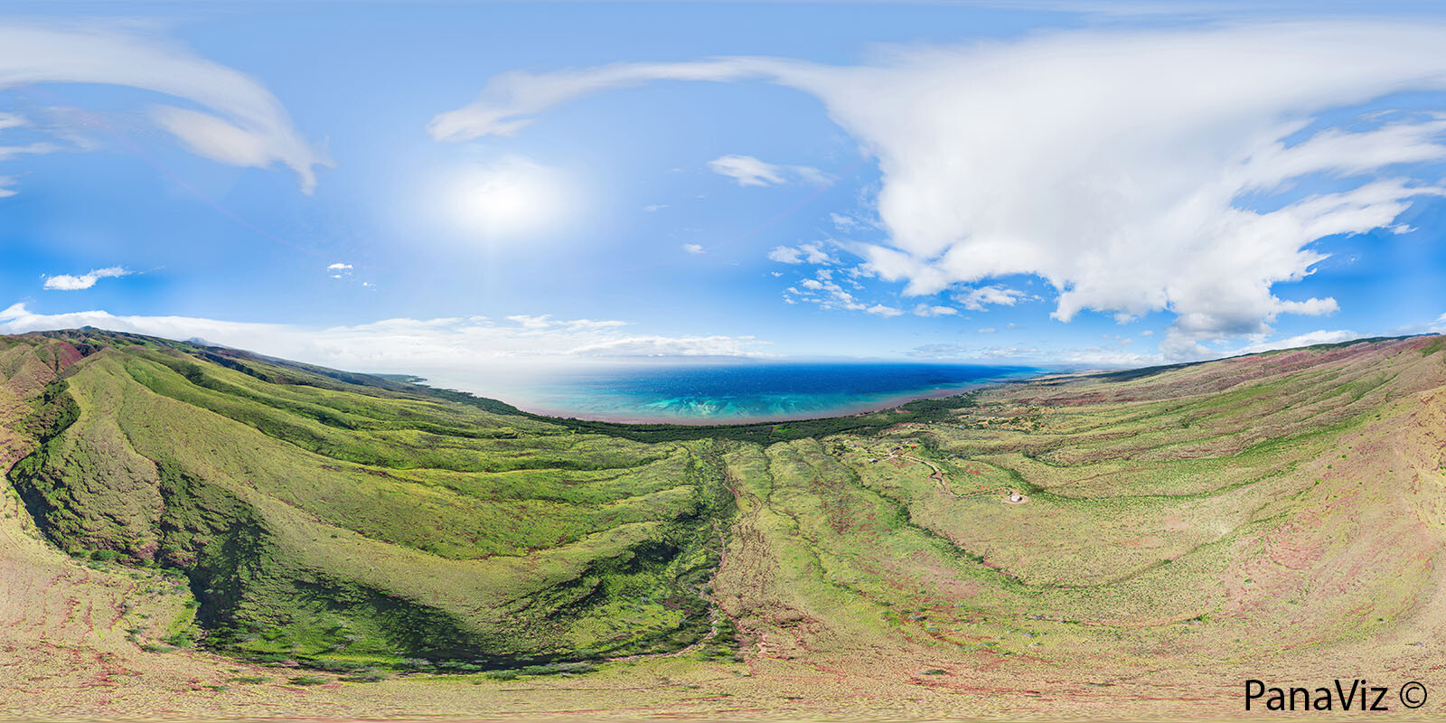
South Molokai Panorama
See our photos and virtual tour of Hawaiian Railway Society: Parlor Car 64
See More of my Panoramic Photography here.